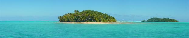
Aitutaki, the most frequently visited of
the outer Cook lslands enjoys a way of life
that has escaped relatively unscathed by
the coming of Western ways and is reminiscent
of of "old Polynesia". Aitutaki’s
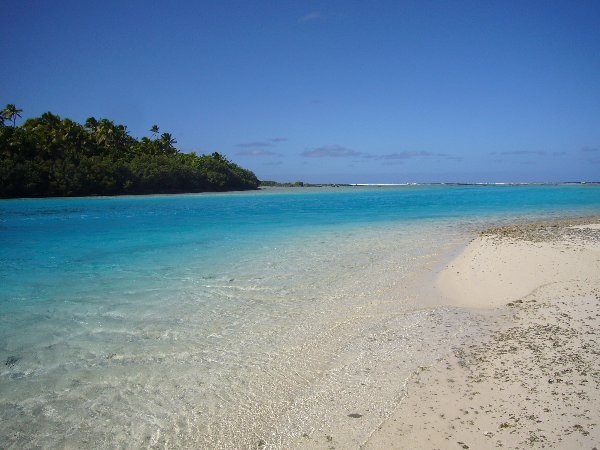
deep blue lagoon is considered to be one
of the most beautiful lagoons in the world.
Part volcanic and part atoll, the island’s
geographical structure makes the lagoon unique.
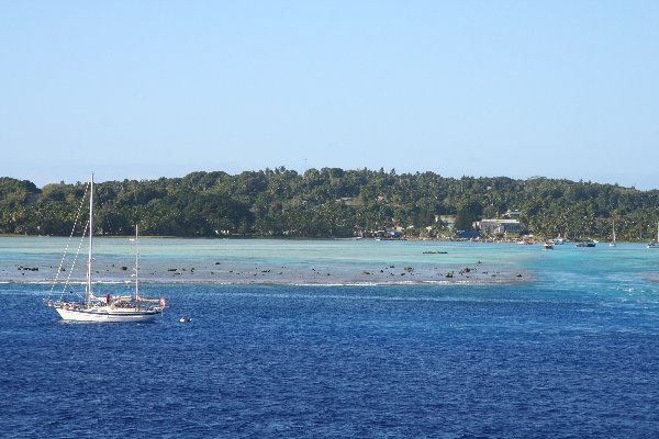
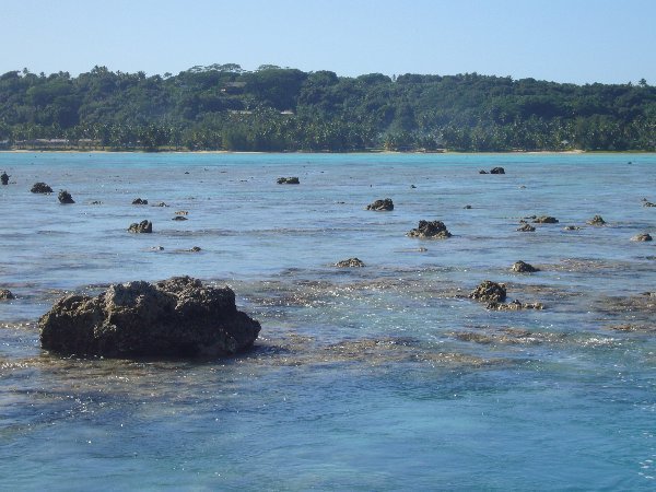
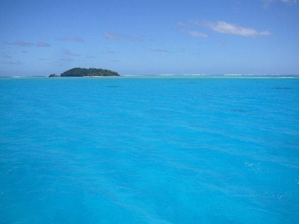
For our trip we boarded several local boats
that varied in size and shape. We cruised
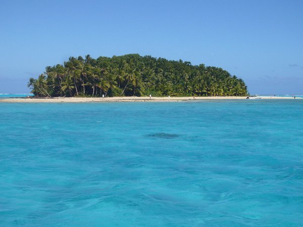
passed many of the tiny offshore motus, passing
Motu Akaiami, which was once used as a refuelling
stop for the flying boats back in the 1950s.
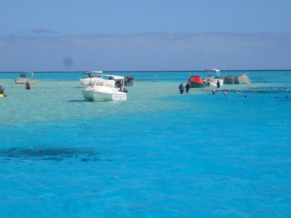
We stopped in the shallow part of the lagoon
and enjoyed some snorkelling – it was
rather strange to be a long way from the
closest land, but able to stand in the water.
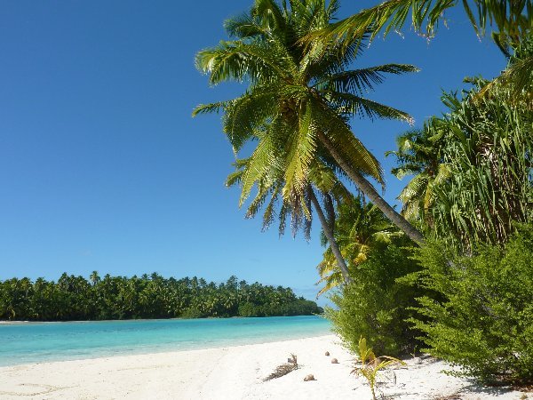
We stopped at One Foot Island for lunch of
barbeque fish, salads and fresh fish after
which we relaxed, walked around the island
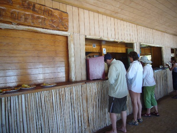
and snorkelled. One Foot island its own postcards
and stamps, surely this has to be one of
the remotest post offices in the world! .
Aitutaki is often referred to as "the
Bora Bora of the Cook lslands" because
it consists of a small, hilly island at the
apex of a triangular barrier reef dotted
with skinny flat islets. This reef necklace
encloses one of the South Pacific's most
beautiful lagoons.
The central island, only 8 square miles in
area, is dotted with the coconut, pineapple,
banana and tapioca plantations that are worked
by most of the island's 2,500 residents.
A few Aitutakians make their living at the
island's hotels, but the land and the
lagoons still provide most of their income.
Legend says that in the beginning Aitutaki
was completely flat but then its warriors
sailed to Rarotonga and stole the top of
Mount Raemaru. Pitched battles were fought
on the way home and parts of the mountain
fell into the sea. In the end, the Aitutakians
warriors were victorious and the top of Raemaru
is now Mount Maungapu, the highest point
on Aitutaki at 407 feet.
According to another legend, the first Polynesians
to reach Aitutaki came in through Ootu Pass,
led by the warrior and navigator Ru, who
brought four wives, four brothers and a crew
of 20 young virgins from Tubuai in what is
now French Polynesia. Akitua island where
they landed originally named Urituarukitemoana
which means "where Ru turned his back
on the sea ".
Polynesian myth believes that beautiful Aitutaki
is a giant fish tethered to the seabed by
a vine from the air. The light turquoise
lagoon looks like a huge pale oyster against
the vivid blue ocean.
The first European to visit Aitutaki was
Captain William Bligh who discovered it in
1789 a few weeks before he was set adrift
in Tonga by the mutinous crew of H.M.S Bounty.
Today the people live in villages strung
out along the roads on both sides of the
main island and travel about on motor scooters.
The roads are red-brown in the centre of
the island and coral white around the edge.
Every village has a community hall and there
was tremendous competition between villages
to have the biggest and the best, so the
halls are splendid in size and seldom used.
The low rolling hills of the island are flanked
by banana plantations and coconut groves.
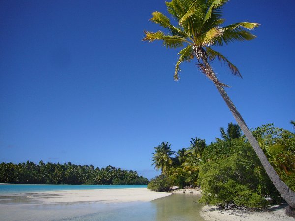
A triangular barrier reef seems to catch
the exquisite turquoise Aitutaki lagoon like
a giant fishhook. The turquoise crystal clear
water in the lagoon is perfect for sailing,
swimming and snorkelling and beneath the
blue surface is a wonderful world of sea
creatures and plants.
In the days when the so-called ‘flying
boats’ dominated travel around the
South Pacific, Aitutaki was one of the region’s
major airport on the ‘Coral Route’
which connected the triangle of New Zealand,
Tahiti, Fiji, Samoa and the Cook Islands.
One story tells of a time when the flying
boat had an engine failure and the pilot
flew to Fiji to get the plane repaired. When
he returned none of the passengers wanted
to leave – I know how they felt!